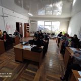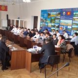
С 4-8 июля 2016 года в г. Будапешт прошел семинар по геопространственным технологиям и дистанционному зондированию для мониторинга целей устойчивого развития
В семинаре «Геопространственные технологии и дистанционное зондирование для мониторинга целей устойчивого развития» приняли участие сотрудники отдела реализации проекта «УНВР Ф-1» координатор ИСВ Карыпов А.А. и ГИС специалист Абдрахманова Г.А.
В ходе семинара были заслушаны доклады зарубежных лекторов из таких ведущих организаций как: UNOOSA, Австрия– Лорант Зоран, ESRI, Швейцария — Мартин Енглс, Google Великобритания — Ед Парсонс, GEO Швейцария – Дуглас Крип и из DG EU-JRC Италия – Аллан Белвард.
Согласно программы семинара международные специалисты провели практические занятия для закрепления и усвоения материала, на которых были показаны примеры работ в области ГИС и Дистанционного зондирования Земли. В целом семинар прошел успешно и продуктивно. Появились новые знакомые в области использования этих программных продуктов с которыми будет поддерживаться тесная связь для обмена опытом по средствам социальных сетей и интернета.
В завершающий день некоторые участники представили свои опыт тематических исследований и презентовали свои наработки, в числе которых Карыпов А.А рассказал о целях и задачах проекта Всемирного Банка и видение создания информационной системы по воде в Кыргызской Республике. Так же специалисты из GEF, США – Анупам Ананд, WRI, США Емили Нильсон, CEU Венгрия Сусана Габор поделились своими знаниями и достижениями в области ГИС и Дистанционного зондирования земли.
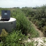
Применение дистанционного зондирования земли (ДЗЗ) в водном секторе дает возможность проводить пространственный анализ сравнивая существующие спутниковые снимки разных лет с изменениями русла реки, водохранилищ и озер. Данный метод применим только с использованием мультиспектральных снимком разных источников и времени съемки.
[envira-gallery id=»1744″]